Skip to search
Skip to main content
Digital Commonwealth
Folders
Sign Up / Log In
Search for
Search
Search
Search
Basic
Advanced
Explore
Map
Collections
Institutions
Formats
For Educators
Primary Source Sets
Lesson Plans
Using Primary Sources
Searching Digital Commonwealth
For Institutions
How to Contribute Collections
Digitization Services
Frequently Asked Questions
Collection Development Policy
About
About Digital Commonwealth
News & Announcements
Copyright & Terms of Use
Harmful Content Statement
Partners
API
Contact Us
Williams College
Williams College and Williamstown Map Collection, 1876-1987
Lauren H. Healy & William B. Sprague: map of Williams College, 1935
View this item online at Williams College
Item Information
Title:
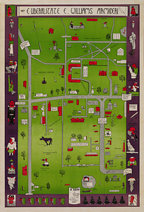
Lauren H. Healy & William B. Sprague: map of Williams College, 1935
Description:
A [humorous] map of Williams College in the year 1935, Lauren H. Healy & William B. Sprague, Jr., executors. Williams College Archives: Map Collection, large format
Cartographer:
Healy, Lauren H.
Cartographer:
Sprague, William B.
Date:
1935
Format:
Maps/Atlases
Location:
Williams College
Collection (local):
Williams College and Williamstown Map Collection, 1876-1987
Subjects:
Williams College
Williams College--Williamstown (Mass.)
Places:
Massachusetts
>
Berkshire (county)
>
Williamstown
Link to Item:
https://williams.alma.exlibrisgroup.com/discovery/delivery/01WIL_INST:01WIL_SPECIAL/12289187140002786
Terms of Use:
Contact Archives and Special Collections at archives@williams.edu
Contact host institution for more information.
Language:
English
Identifier:
maps:11
show more...
View MODS XML
More Like This
Alexander Walker: map of Williamstown, 1889
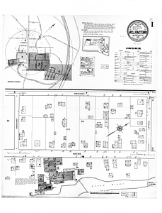
Sanborn Perris: map of Williamstown, 1922
W.N. Tuller: plan of property of the president and trustees of ...
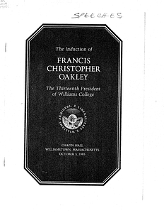
Induction Address of President Francis Christopher Oakley
Find More Like This >>
Tools
Share
Facebook
Pinterest
X
Reddit
Tumblr
Email
Copy link
Add to Folder
Questions/Comments
Cite This Item