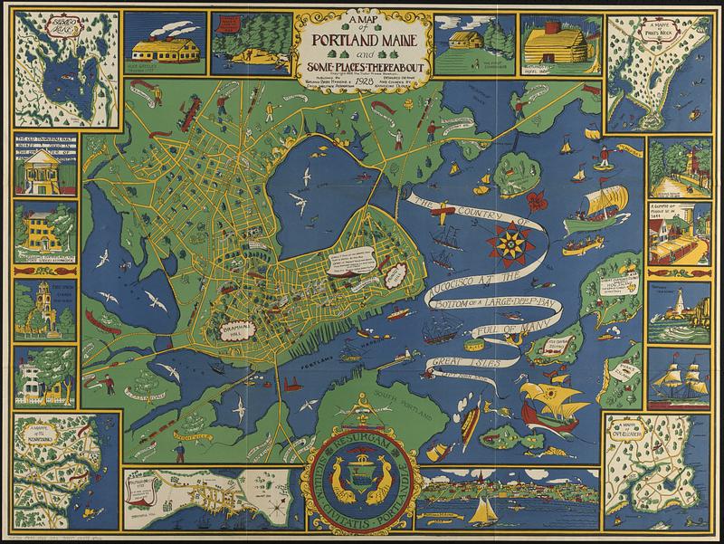
Oriented with north to the upper right.
Some buildings shown pictorially.
Includes notes about locations or historic events.
Border includes 5 maps, 13 illustrations of buildings or places, and illustration of the city seal.
Maps in border: Sebago Lake -- A mappe of the Kennebunks -- Falmouth Neck 1775 as it was when destroyed by Mowett -- A mappe of Cape Elizabeth -- A mappe of Prout's Neck.
"Copyright 1928, the Tudor Press, Boston."